Category 3 Isaias made Friday evening landfall on the Florida Panhandle with 120 mph winds, as 16,000 linemen stood ready and every Pensacola-area Waffle House closed.
Published 9 October 2026 · 18:00 GMT
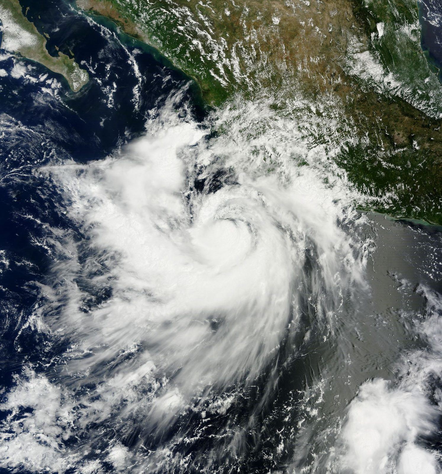
Hurricane Isaias slammed into the Florida Panhandle on Friday evening as a Category 3 storm, its 120 mph winds tearing at a coastline that still carries the scars of Hurricane Michael and driving a storm surge ashore as darkness fell. Gov. Ron DeSantis told residents in the storm's path to assume they would lose power, with 16,000 linemen staged across the region ready to move in once the winds dropped. And in the detail that Floridians read like a siren, every Waffle House in the Pensacola area closed its doors, pushing the unofficial Waffle House Index, the disaster gauge watched by FEMA, to red, its worst color. The storm that arrived on Friday was forecast with tools that did not exist a few years ago: the National Hurricane Center's director said this week that AI models, led by Google DeepMind's WeatherNext, are now fully woven into the forecasts that guided the evacuations.
Isaias came ashore on the Florida Panhandle on Friday evening with maximum sustained winds of 120 miles per hour, a Category 3 on the Saffir-Simpson scale, after a day in which the storm's predicted track locked onto the Panhandle with unusual confidence. The landfall zone, a stretch of coast that has never fully recovered from Hurricane Michael's 2018 rampage, faced the combination forecasters fear most: destructive winds arriving at nightfall and a storm surge pushing water into bays and inlets as residents hunkered down. Power failures began spreading within hours, the opening act of the outage wave the governor had warned about.
At a Friday briefing, Florida Gov. Ron DeSantis said 16,000 linemen were staged and ready to begin restoration work as soon as winds fell to safe levels, and he gave residents the bluntest possible guidance: assume you are going to lose power. The number is a measure of the expected damage as much as of the response. Utility crews summoned through mutual-aid agreements from across the Southeast do not mass in those numbers unless forecasters expect the grid to take a severe beating, with snapped poles, tangled transmission lines and substations swamped by surge. Staging them ahead of landfall, rather than summoning them after, is the expensive lesson of every recent Gulf hurricane: every hour of daylight lost to mobilization is an hour neighborhoods sit dark.
Green is dinner, yellow is a generator, red is the storm telling the truth.
By Friday evening, every Waffle House in the Pensacola area had closed, and the unofficial index that emergency managers treat as a field gauge went red, its worst of three colors. The logic is disarmingly simple: Waffle House almost never closes. Its restaurants are built to run through storms, with generators, stripped-down storm menus and company "jump teams" flown in from states far from the impact zone, on the theory that neighboring states are busy tending their own evacuees. When a location that plans for disaster cannot stay open, the reasoning goes, the damage around it is severe. Red does not mean a bad night for breakfast. It means the federal playbook's worst box is checked.
The index was invented by Craig Fugate, who dreamed it up while running Florida's emergency management agency in 2004. Surveying the wreckage of Hurricane Charley and hunting for something to eat, he found a Waffle House running on a limited menu, and his team began marking open and closed locations on a color-coded map that became a fixture of the state's damage picture. He carried the map to FEMA, which he led under President Barack Obama. The tiers are plain: green means a full menu and working power, damage likely light; yellow means a limited menu, the restaurant on generator power with thinning supplies; red means closed, and, in Fugate's words: "If you get there and the Waffle House is closed, that's really bad. That's where you go to work."
The index earned its reputation in storms like Michael. In 2018, as that hurricane bore down on the same Panhandle coastline, Waffle House closed 30 restaurants, a rare mass shutdown that foreshadowed what followed: Michael, later upgraded to a Category 5 with 160 mph winds, became the first storm of that strength to strike the United States mainland since Andrew in 1992, killing 16 people and causing about $25 billion in damage. The company even runs its own storm center, and its color-coded closure maps are shared publicly during landfalls, which is why the Pensacola shutdowns on Friday registered far beyond Florida: a red index is the rare signal that cuts through official jargon.
The forecast that put those 16,000 linemen in place was shaped by tools that barely existed two hurricane seasons ago. Michael Brennan, the director of the National Hurricane Center, spoke to USA Today on Oct. 8 as Isaias approached the coast, and described a center transformed: 2026 is the first season in which Google DeepMind's WeatherNext model has been fully incorporated into the suite of forecasting aids the center uses, after testing and evaluation through 2025. Trained on nearly 20 terabytes of atmospheric data and almost 5,000 historical storms, the model can generate a 15-day track and intensity forecast in under a minute, and a study in the journal Nature found it adds roughly a full extra day of warning on track, intensity and wind structure.
The precedent that converted the skeptics came in 2025, when Hurricane Melissa roared toward Jamaica. WeatherNext gave the center the confidence to issue an unusually aggressive intensity forecast, calling Melissa's rapid intensification with about 80 percent confidence five days before landfall, rising to near certainty three days out, and it was right. James Franklin, a retired former branch chief of the center's hurricane specialists, called the AI gains "quite remarkable" and said he had not seen anything so dramatic in his career. The official human forecast remains the most consistent guidance, Franklin noted, but no forecaster now builds a track forecast without checking the Google DeepMind guidance first.
For Isaias, that meant the Panhandle landfall was telegraphed earlier and with tighter confidence than the physics-only era allowed, which is why evacuation orders, shelter openings and the linemen staging all moved on a longer fuse. Brennan stressed that humans still make the forecast: the machine learning models are, in his words, valuable new tools in the toolbox, and it is the forecaster who translates track, intensity and size into the hazard warnings people act on. But the direction of travel is unmistakable. A model that finds patterns in decades of cyclone data, without being taught the physics of the atmosphere, is now outperforming the dynamical models on track, and emergency managers are planning around the extra day it buys.
Nobody on the Panhandle needed a history lesson on Friday, but the numbers explain the dread. Hurricane Michael made landfall near Mexico Beach on Oct. 10, 2018, with 160 mph winds after crossing western Cuba as a Category 2. NOAA's post-storm analysis put storm surge at 9 to 14 feet above normal along parts of the Panhandle, flattened more than three-quarters of the homes in Mexico Beach, damaged 1,584 of the town's 1,692 buildings and destroyed 809 of them, and left every building at nearby Tyndall Air Force Base damaged, with about $3 billion in damage there alone. The U.S. toll reached $25 billion, with another $4.7 billion in Georgia, and the region was still rebuilding years later. Isaias arrived weaker, a Category 3 at 120 mph, but on a coast whose margin for a second blow was already thin.
The economics of the coming week are already taking shape in the dark. Staging 16,000 linemen is one of the most expensive bets a utility system makes, and it is made precisely because the alternative, days of cascading outages with crews trickling in, costs more in spoiled food, shuttered businesses and idle wages. Outage economists have long argued that the true price of a hurricane is measured less in the wind field than in the duration of the blackout, and DeSantis's warning, assume you will lose power, was as much economic triage as safety advice: the faster residents prepare for days without refrigeration and air conditioning in the Florida heat, the smaller the secondary toll. Even the Waffle House closures carry an economic signal. A red index marks the moment the local economy stops functioning, and its return to yellow, limited menu on generator power, is often the first reliable sign that commerce is breathing again.
Friday night will decide Isaias's ledger. Storm surge is the historic killer in Panhandle hurricanes, and surge heights will not be fully known until gauges are read and daylight damage surveys begin. Tornadoes embedded in the storm's outer bands, the kind Michael spun off at least 16 of, are an overnight threat that no forecast can fully localize. And the power numbers will climb before they fall: utilities restore in sequence, hospitals and water plants first, then the densest neighborhoods, then the long rural feeders of the Panhandle's pine country, where the last customers can wait weeks.
By dawn, the Waffle House Index will start telling the recovery story in reverse. The first yellow dots on the company's closure map, a generator humming behind a limited menu, will mark the places where the grid is close enough to touch. Green will follow: full menu, lights on, the small normalcy that made a breakfast chain an unlikely instrument of federal disaster assessment. On Friday night, though, the map was red over Pensacola, and red, as Fugate taught a generation of emergency managers, is where you go to work.
From the Western reading, Isaias is a systems test that America is built to pass, and the iconography is doing half the storytelling. The Waffle House Index turns a federal disaster metric into folk culture, the jump teams and storm menus into a parable of private-sector readiness, and WeatherNext into the latest proof that Silicon Valley compute, pointed at a public problem, buys something no appropriations bill can: time. DeSantis staging 16,000 linemen before landfall reads in this telling as competent governance, the expensive, visible kind, and the AI-guided evacuation timeline as the payoff of a decade of forecast investment.
But the sharper Western analysts are already doing the accounting. Sixteen thousand staged linemen are paid for by someone, and in Florida that someone is ultimately the ratepayer, through utility cost recovery and the insurance repricing that follows every Gulf landfall. The AI forecasting triumph has a bill attached too: the compute, the data pipelines, the research flights that still feed the models. The Western question underneath the resilience narrative is distributional, who pays for the extra day of warning, and whether the households least able to evacuate are the ones who benefit from it least.
From the Eastern reading, Isaias is first a stress test of American infrastructure, watched with professional interest rather than schadenfreude. Moscow and Beijing track U.S. grid fragility the way Washington tracks theirs, and a Category 3 exposing the Panhandle's power system is data, not drama. The AI forecasting story is the more interesting file: WeatherNext's open-sourcing on GitHub is read as a genuine technology transfer, the kind that lets meteorological services everywhere run world-class guidance without a supercomputer, and the NHC's public embrace of a corporate model is noted as a case study in how states absorb private AI capability.
The Eastern lens is also the most skeptical of the triumphalism. One strong season does not retire forecast uncertainty, and the hard problem, rapid intensification in the hours before landfall, is exactly what makes a 120 mph landfall forecast a gamble no model fully removes. For analysts in this camp, the lesson of Isaias is narrower and colder: forecasting skill is not adaptation. An extra day of warning is worth little to the household that cannot afford to leave, and no model rebuilds a substation.
From the Global South reading, the storm does not stop at the Florida line, and neither should the attention. The same cyclones that batter the Panhandle rake Cuba, the Bahamas, Jamaica and Haiti with a fraction of the linemen, the generators and the insurance. When Isaias's Panhandle landfall dominates the coverage, the Southern question is which Caribbean landfalls, evacuations and outages got a paragraph instead of a live blog, and whether the recovery money will follow the cameras or the damage. The Waffle House Index, in this telling, is a rich-country luxury: the South's disaster index is whether the clinic has diesel.
There is, however, one genuinely good piece of news for the South in this storm. WeatherNext is open source, which means a meteorological service in the Caribbean or West Africa can now run guidance that beat the dynamical models without buying a supercomputer, and the Melissa precedent, an accurate five-day intensity call for Jamaica, is the proof that it works where the South lives. If the AI forecasting revolution has a moral, it is this: the extra day of warning must belong to everyone in the storm's path, not just the coastline that can afford 16,000 linemen.
It is an informal disaster gauge invented by former FEMA administrator Craig Fugate while he ran Florida's emergency management agency in 2004. Because Waffle House restaurants almost never close, their status is a proxy for local damage: green means a full menu and working power (damage likely light), yellow means a limited menu on generator power, and red means the restaurant is closed, which signals severe damage. FEMA has used it as a field-level complement to official damage assessments.
Utilities pre-position repair crews through mutual-aid agreements so restoration can begin the moment winds drop to safe levels, instead of losing daylight hours to mobilization after the storm. Crews are staged outside the impact zone and moved in behind the storm. The scale of the staging reflects the expected damage: forecasters anticipated widespread snapped poles, downed lines and flooded substations across the Panhandle.
2026 is the first hurricane season in which Google DeepMind's WeatherNext model is fully incorporated into the National Hurricane Center's forecasting aids, after testing in 2025. Trained on decades of atmospheric data, it finds patterns traditional physics-based models miss, and a Nature study credited it with roughly an extra day of warning on track and intensity. It proved itself in 2025 by accurately forecasting Hurricane Melissa's rapid intensification days before its Jamaica landfall. Human forecasters still make the final call.
Michael, which hit the same Panhandle coastline on Oct. 10, 2018, was far stronger: later upgraded to Category 5 with 160 mph winds, it killed 16 people in the U.S. and caused about $25 billion in damage, flattening much of Mexico Beach. Isaias made landfall as a Category 3 with 120 mph winds. The concern is that it struck a coastline whose housing, infrastructure and insurance markets were still recovering from Michael.
